Welcome to Algorithms for Quantitative Pedology project!
A collection of algorithms related to the modeling of soil resources, soil classification, soil profile aggregation, and visualization.
Algorithms for Quantitative Pedology (AQP) is a collection of code, ideas, documentation, and examples wrapped-up into several R packages. The theory behind much of the code can be found in this Computers & Geosciences paper. Links to project member contacts, code, and other information hosted by R-Forge can be found here. Worked examples along with discussion and application to soil survey work can be found on the CA Soil Resource Lab website. AQP is very much a work in progress! If you are interested in contributing code, documentation, bug reports, or even scathing criticism, feel free to contact Dylan at debeaudette [at] ucdavis [dot] edu.
AQP is a collaborative effort, funded in part by the Kearney Foundation of Soil Science (2009-2011) and USDA-NRCS (2011-current).
Presentations:
- 2015 Digital Soil Morphometrics - Aggregate representation of genetic soil horizons via proportional-odds logistic regression
- 2015 Digital Soil Morphometrics - Algorithms for Quantitative Pedology: a toolkit for digital soil morphometrics
- Soil Data Aggregation
- AQP, DSM, and ESD
- Numerical Classification with AQP
- AQP and SoilDB Demo
- 2011 UseR AQP Talk
- 2011 Pedometrics
Tutorials:
- SoilProfileCollection object introduction
- dealing with bad data
- aggregate properties by taxon name
- aggregate properties by bedrock kind
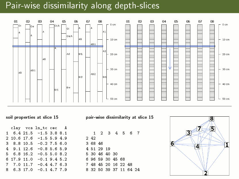
- soil profile dissimilarity
- vertical vs. perpendicular horizon measurements
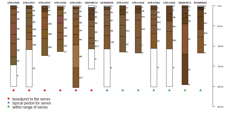
- getting, plotting, saving detailed soil series extent data (US-only)
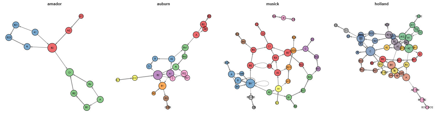
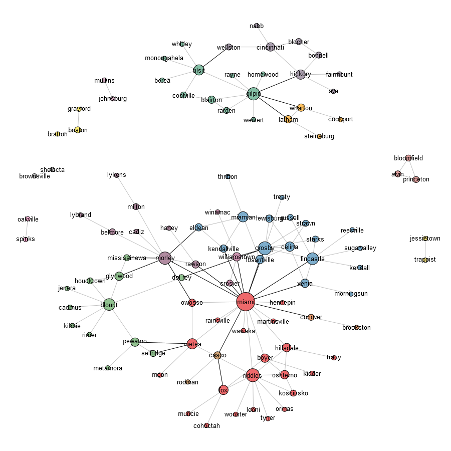
- Component Relation Graphs
- A Novel Display of Categorical Data
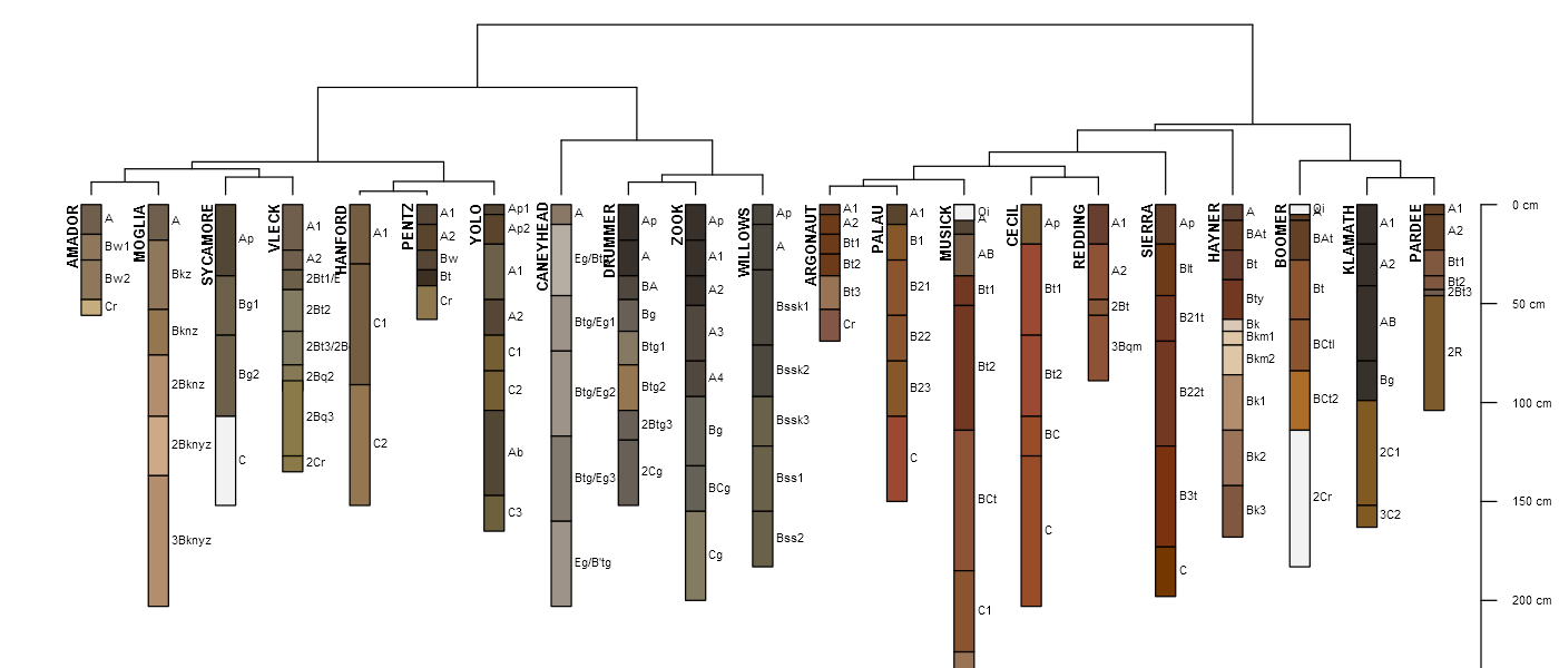
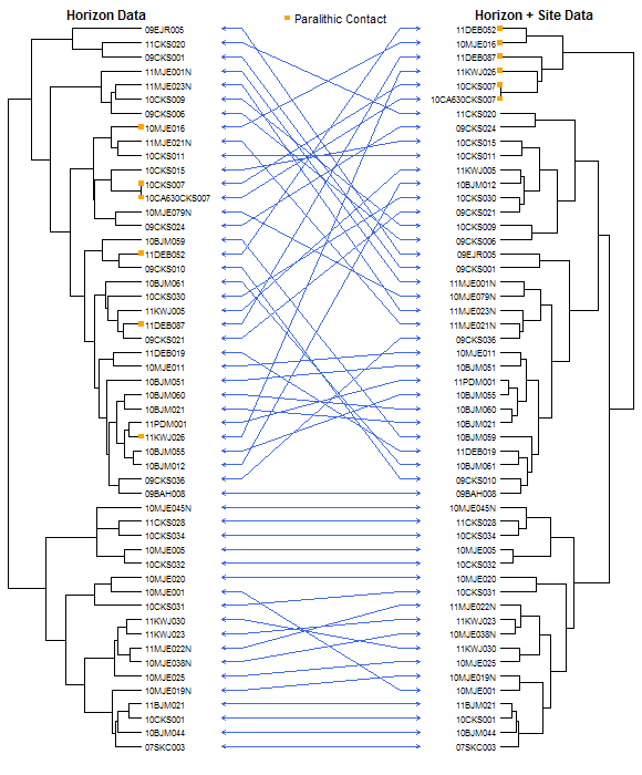
- OSD Dendrogram
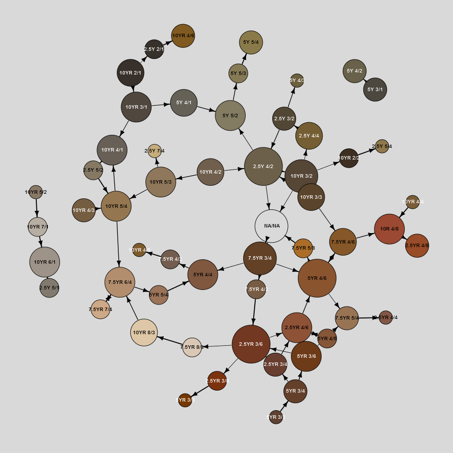
- Horizon Transition Probabilities
- USDA-NRCS Data Sources
- getting soils data from USDA-NCSS databases
- Querying the Soil Data Access web service
- Component interpretation comparison via SDA
- getting/comparing KSSL data
- Loading NASIS pedon data
- Loading NASIS component data
- Export NASIS pedon data to SHP file
- Export NASIS pedon data to Google Earth
- gridded SSURRGO (gSSURGO) and SDA
- Pedon Data Aggregation
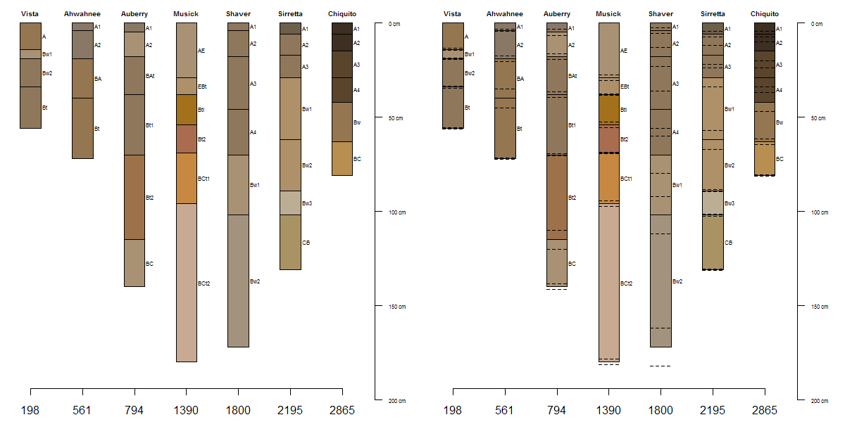
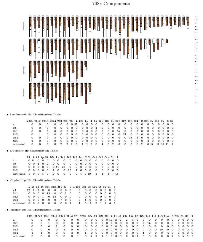
- Assignment of generalized horizon labels
- Computing range in characteristics by generalized horizon label
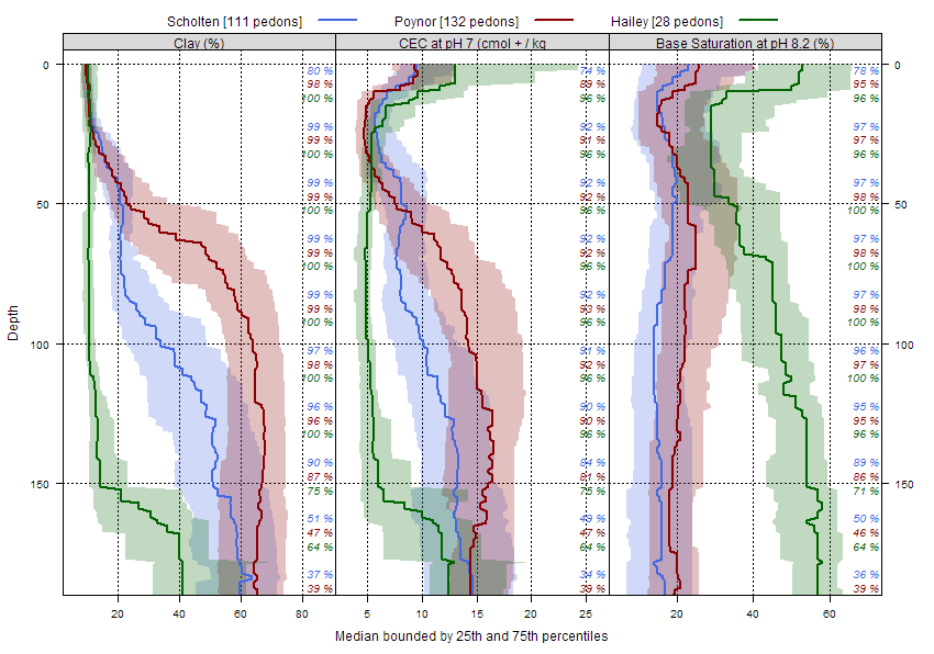
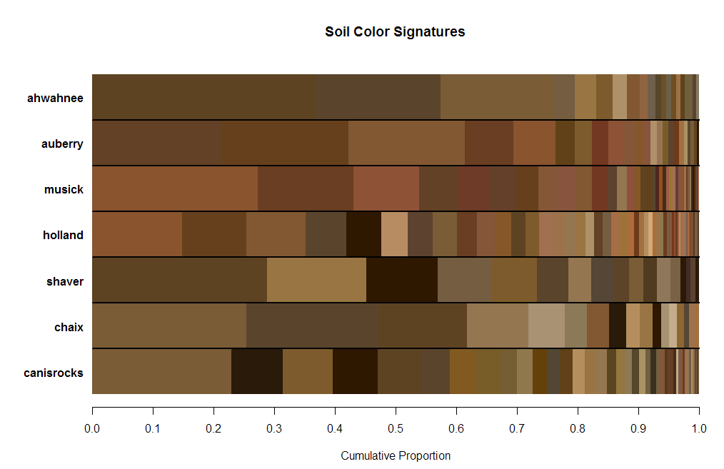
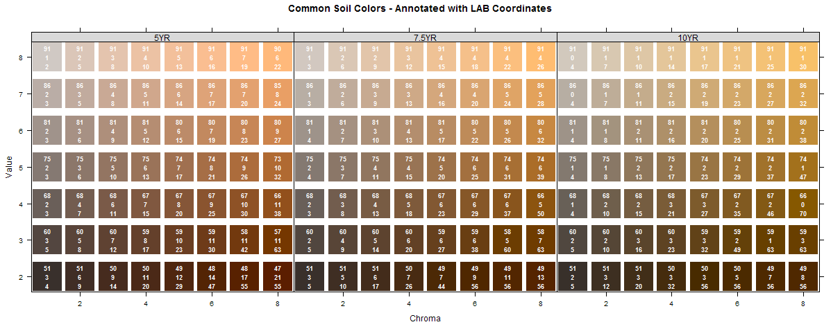
- Soil color aggregation ideas
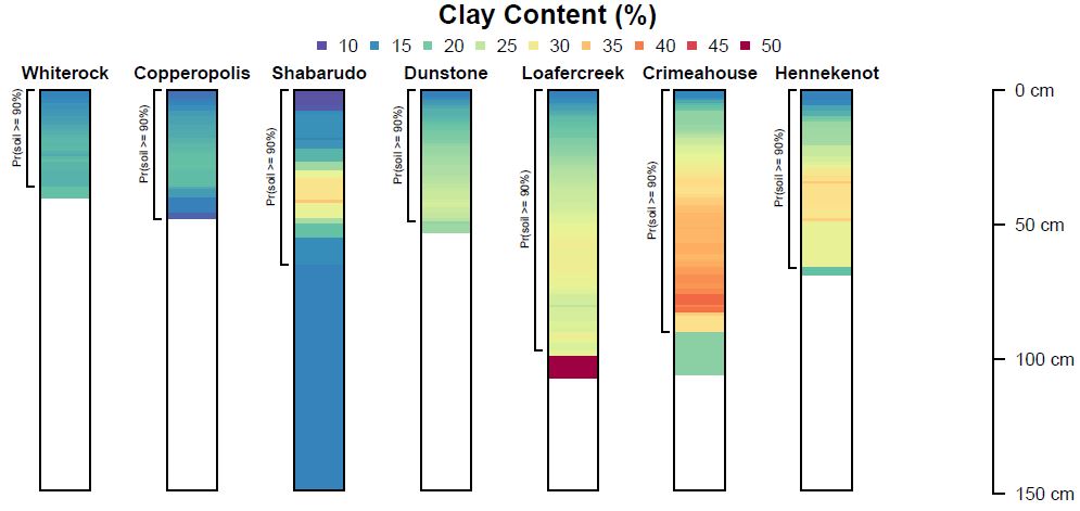
- Estimation of most-likely horizonation
- Sample Reports
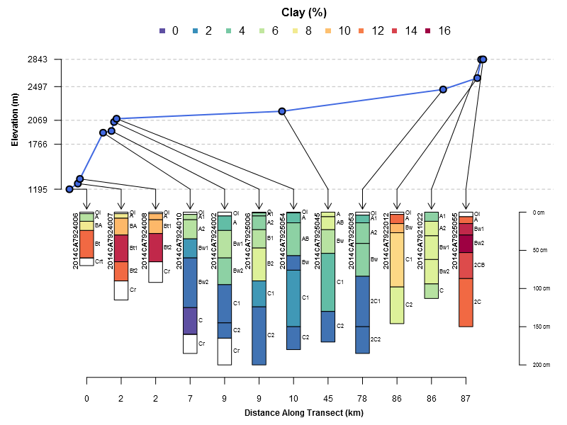
- Spatial Data Aggregation
- Sampling Raster Data Sources
Manual Pages c/o knitr:
- aqp manual pages with figures
- soilDB manual pages with figures
- sharpshootR manual pages with figures
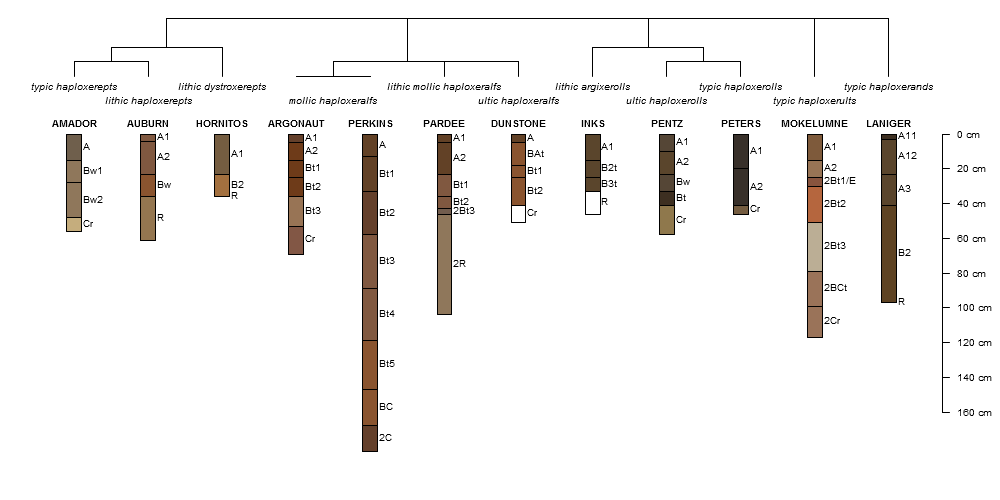
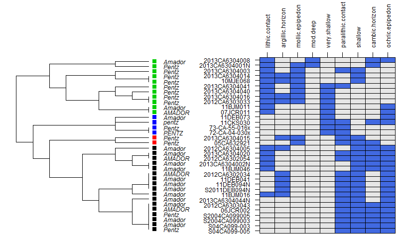
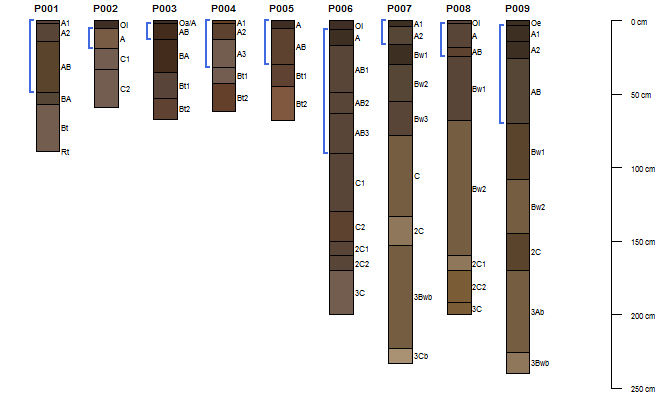
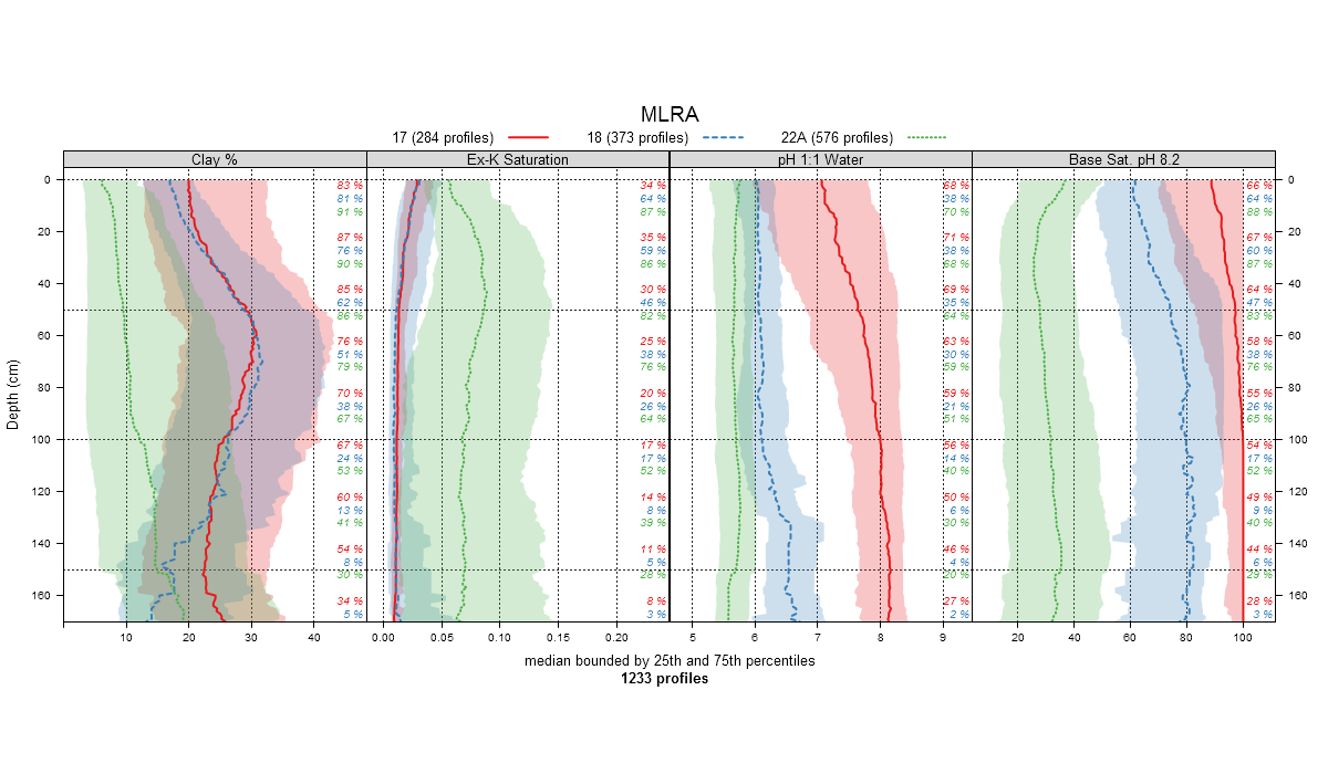
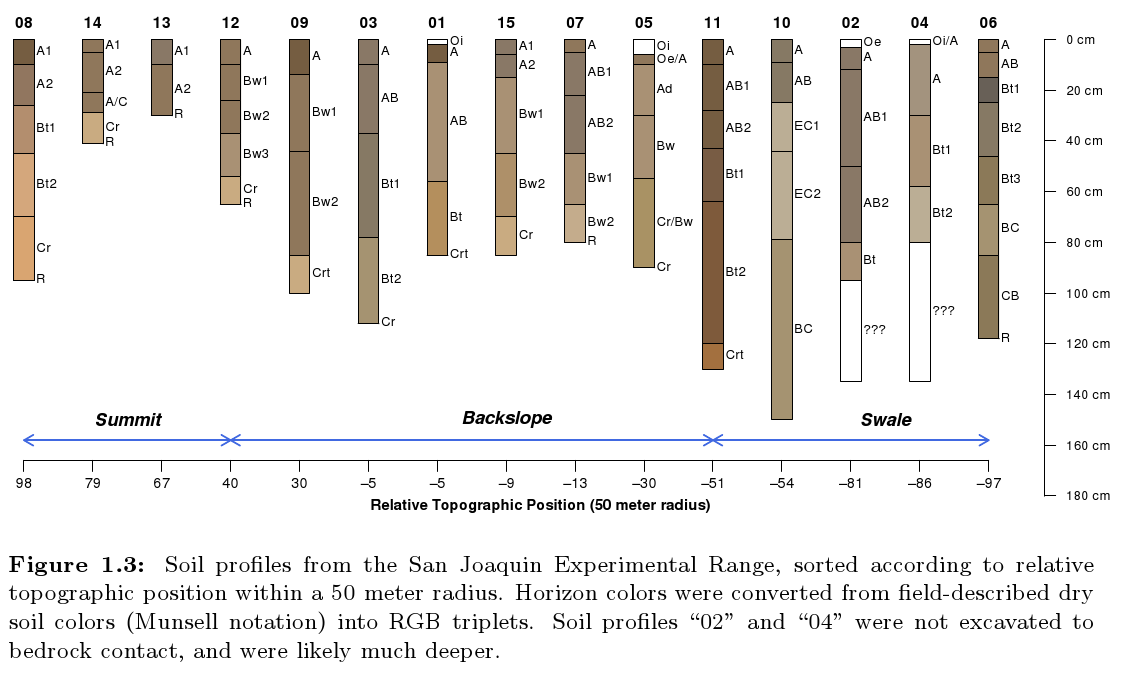
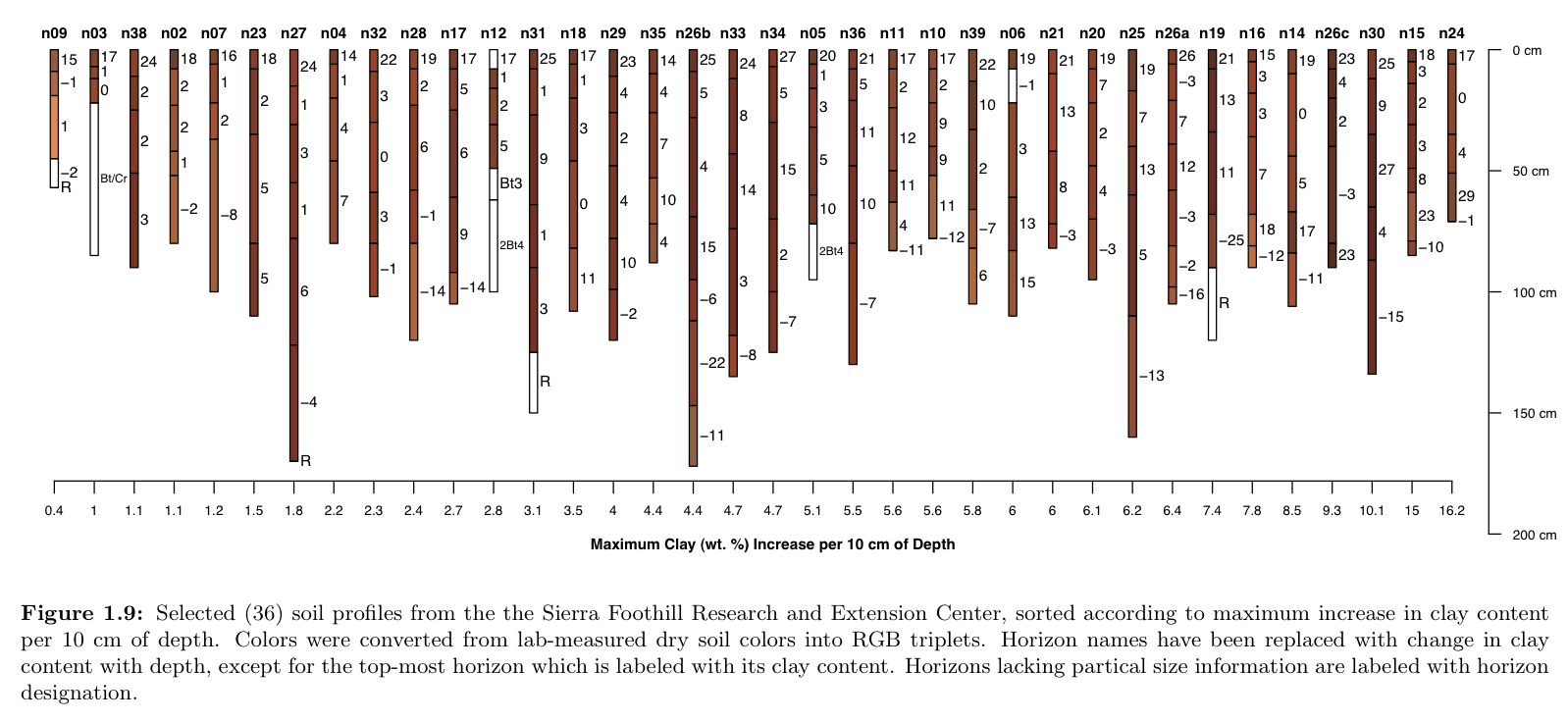
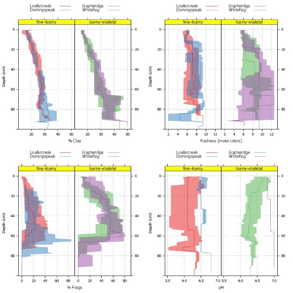
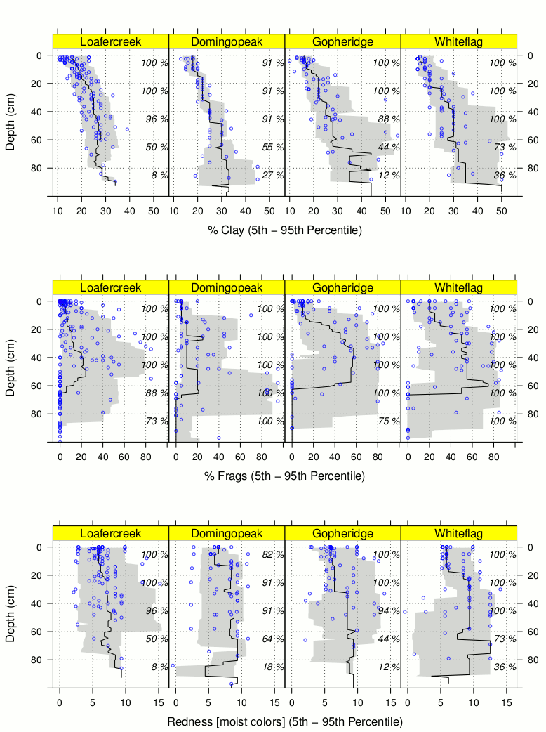
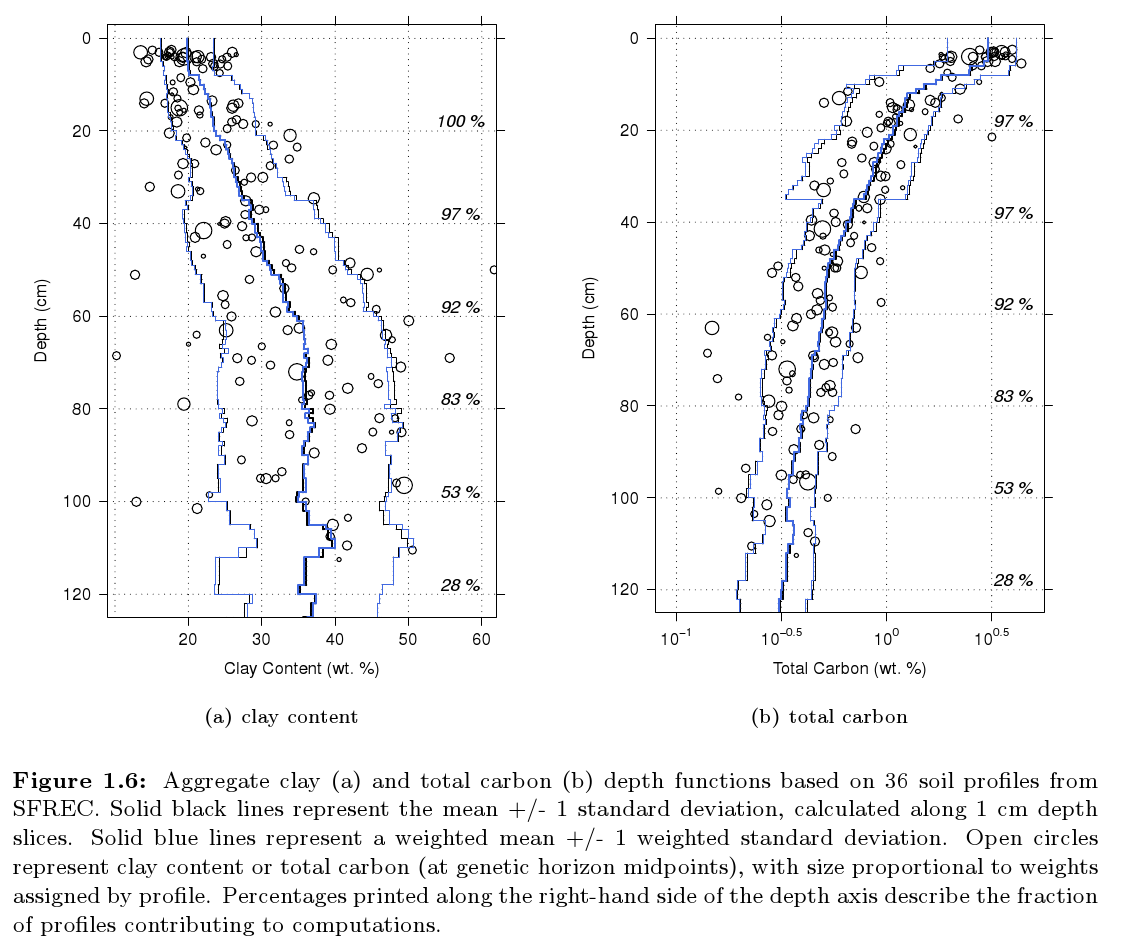
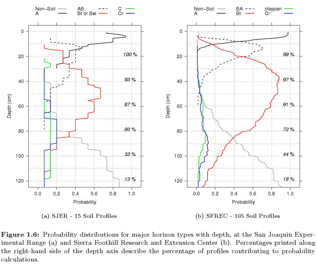
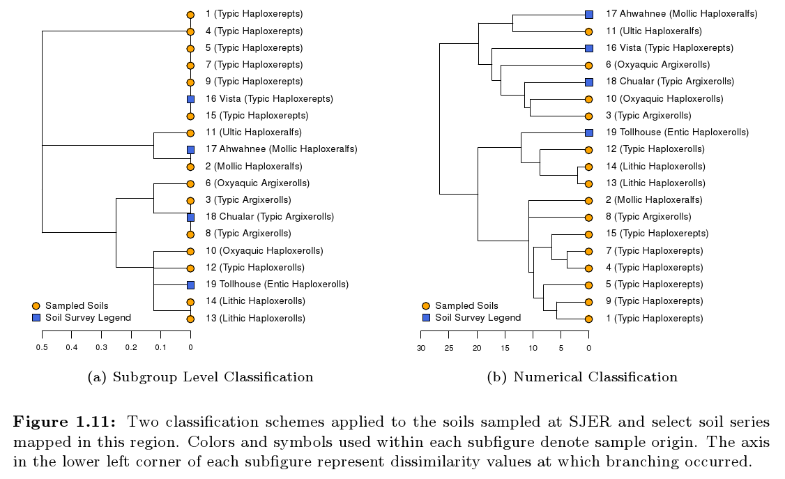
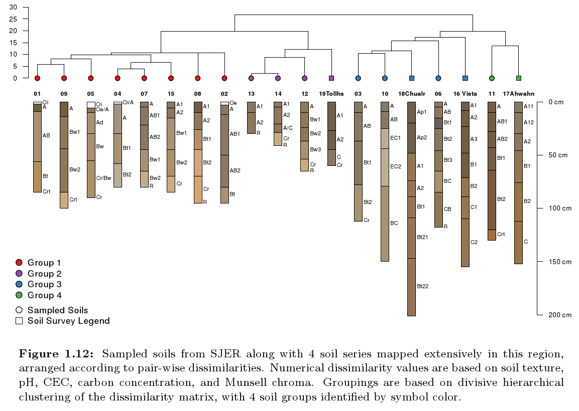
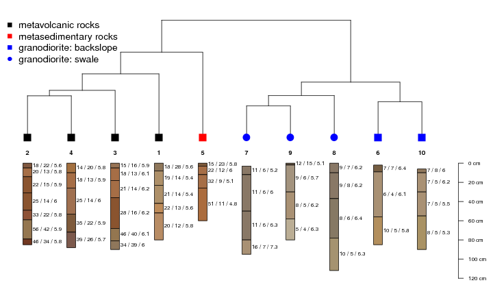
Sample Figures